

Geospatial imagery contains a wealth of information and enabling everyone across an organization to benefit from it has never been more important. Now with the ENVI Ecosystem, the barriers have been removed. Whether it’s maximizing investments in imagery, or doing more with fewer resources, the ENVI Ecosystem is designed to deliver.
For over 30 years, ENVI set the benchmark for image processing and analysis platforms and technology. Today, the ENVI Ecosystem offers a suite of solutions that are easily tailored to diverse organizational needs and users.

The eCognition suite offers three components which can be used stand-alone or in combination to solve image analysis tasks. eCognition Developer is a development environment for object-based image analysis. It is used in earth sciences to develop rule sets (or applications) for the analysis of remote sensing data. eCognition Architect enables non-technical users to configure, calibrate and execute image analysis workflows created in eCognition Developer. eCognition Server software provides a processing environment for batch execution of image analysis jobs.
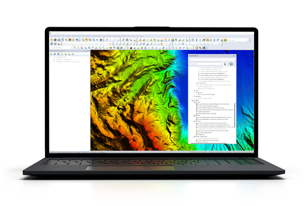
Global Mapper® is a cutting-edge GIS software that provides both novice and experienced geospatial professionals with a comprehensive array of spatial data processing tools, with access to an unparalleled variety of data formats. Global Mapper’s intuitive user interface and logical layout help smooth the learning curve and ensure that users will be up-and-running in no time. Organizations of any size quickly see a significant return on investment brought about by efficient data processing, accurate map creation, and optimized spatial data management.

The Open Source Geospatial Foundation (OSGeo) is a not-for-profit organization whose mission is to foster global adoption of open geospatial technology by being an inclusive software foundation devoted to an open philosophy and participatory community driven development.
An ecosystem of geospatial software and software infrastructure is readily available for assisting in any project you may consider.
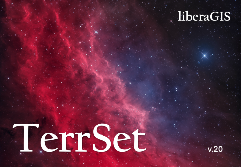
Introducing liberaGIS, the next evolution in geospatial software from Clark CGA. Built on the foundation of IDRISI and TerrSet, liberaGIS offers a streamlined suite of tools for GIS analysis, image processing, and dynamic environmental modeling. This version features powerful capabilities such as the Land Change Modeler, Earth Trends Modeler, and Habitat and Biodiversity Modeler. LiberaGIS retains the essential tools to empower researchers, educators, and professionals to tackle pressing spatial challenges, from land-use planning to environmental monitoring. Learn more.
With a commitment to free and open access, liberaGIS continues the tradition of making world-class geospatial technology available to everyone. Join a global community dedicated to geospatial innovation—download liberaGIS and explore the possibilities!
Manifold Release 9 is a new GIS that runs far faster, delivers superior data science capabilities, cuts through routine GIS tasks, and handles bigger data with better quality than Esri or any other GIS, all at a lower cost of ownership than free alternatives, only $145, fully paid. Manifold delivers blistering speed with rock-solid reliability, even with big data.
Manifold does in nine seconds what takes Esri’s Spatial Analyst twelve minutes, running all the cores in your computer instead of just a few. Manifold is so fast that Esri users can save hours by exporting data to Manifold, doing geoprocessing in seconds, and then importing back into Esri.
SuperMap GIS is developed by SuperMap Software Co., Ltd. It is a complete package of GIS platform software, including Desktop GIS, Service GIS, Component GIS and Mobile GIS platforms and spatial data production, processing and management tools. Through continuous technological innovation, market exploration and experiences accumulation, SuperMap GIS has constructed a good GIS software brand with full angles, and strong functions which can meet different requirements for a wide range of industries, and it has been deeply applied in each GIS industry in China, inspiring a large number of secondary development companies.
Stay updated with the latest news and insights delivered straight to your inbox.
© 1998, 2003, 2025 All rights reserved