
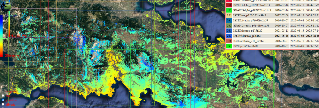
Using SAR remote sensing analysis method of Persistent Scatterers (PS) data, an integrated semi-automated management and analysis system was developed to record ground micromovements. The web-based application offers free access to the analysis results, but obviously a corresponding background of scientific knowledge is required for their interpretation.
More than 425 Projects covering the Balkan and Asia Minor region (with a projected extension for a large part of the Mediterranean basin) with over 125 million points of permanent scatterers generated so far, can provide a first insight into micromovements for further assessment and analysis.
Browse the region of interest and locate data in the areas of interest.
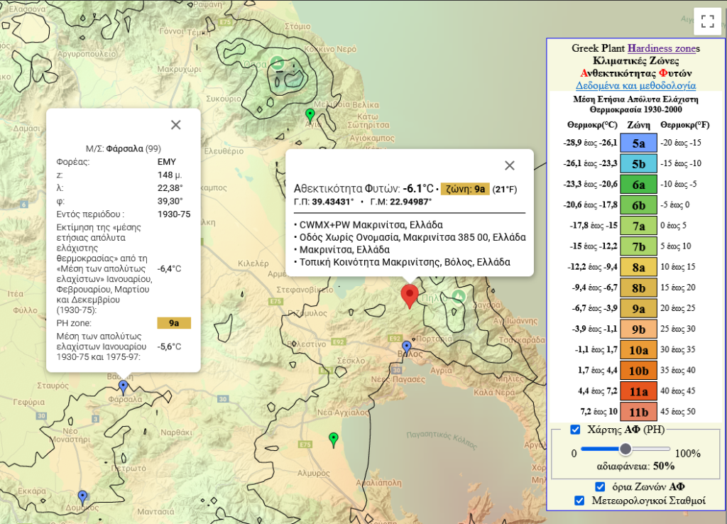
Plant Hardiness for Greece.
Web-based application for the visualization of climatic zones of plant resistance for the Greek territory. Unique recorded application for Greece with the best documented scientific analysis, an indispensable tool from the simple selection of a plant for planting in a yard to the integrated landscape management.
The map was obtained by estimating the values (°C) of the thermometric variable Plant Hardiness (PH) at points (f,l,Z) of a 0.01°x0.01° grid (only above the Greek land) and Natural neighbors interpolation method, through a regression equation and adding, subsequently, to these PH values, the residuals of the same equation for each point of the grid.
Methodology is described within the app in Greek.
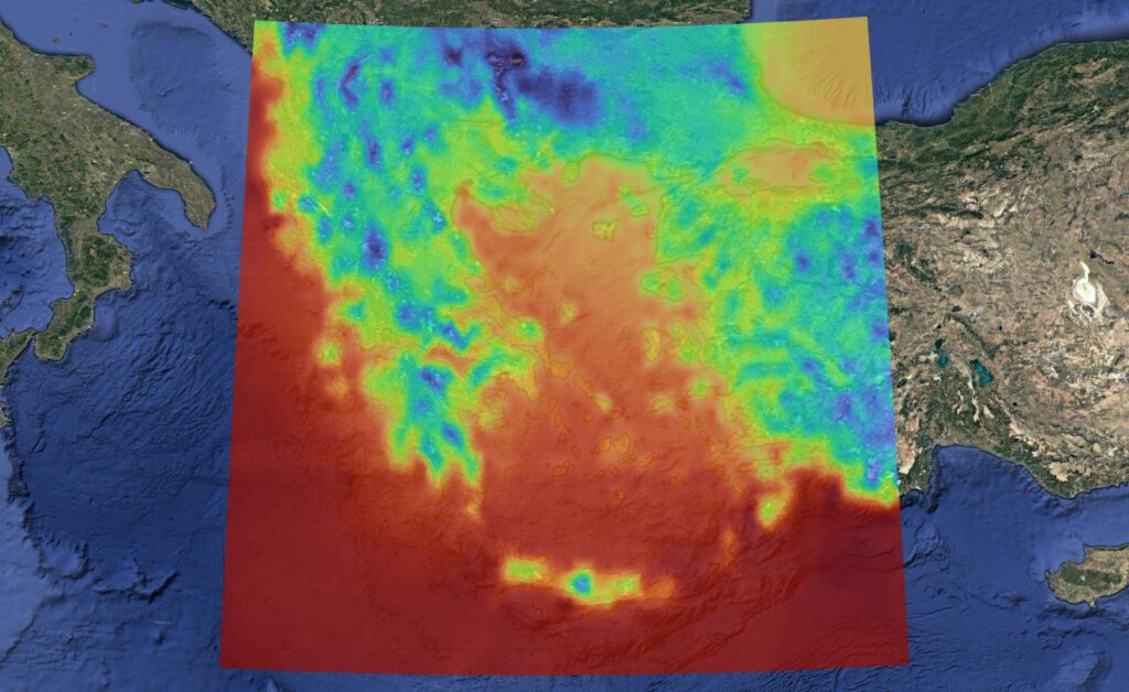
Weather Forecasting with Artificial Intelligence and Global Predictive Model Data.
We developed an advanced weather forecasting methodology for the Greek area, the Southern Balkans and Asia Minor, which utilizes artificial intelligence algorithms for the analysis and prediction of weather variables. Our approach is based on the use of data from major global forecast models, such as IFS and GFS, combined with geospatial information and historical data.
Analysis is carried out for part of the Balkan Peninsula and Asia Minor. It can be extended worldwide.
Link to our Fire Danger Portal: LFDI has been proven suitable for application in Greece. Resuls from other predictive services are also included. Visit our Fire Danger Portal for Greece…
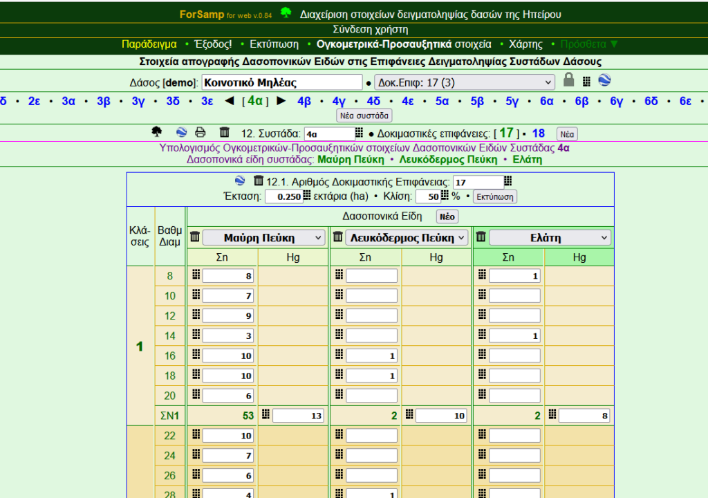
Below we provide links to simple web applications of a forestry nature that originate from much older projects developed by academic institutions and which are not available in their original structure (multimedia apps on CD storage).
The Language is Greek and only by online translation these webpages would make sense to a non Greek speaking / reading.
Follow the links below:
Treatment and management of seeds Woody plants for storage and germination
Stay updated with the latest news and insights delivered straight to your inbox.
© 1998, 2003, 2025 All rights reserved