
Kentucky Launches New Statewide Nadir & Oblique Image Viewer for KYFromAbove
Empowering public access, flexibility, and cost savings through a modern viewing platform
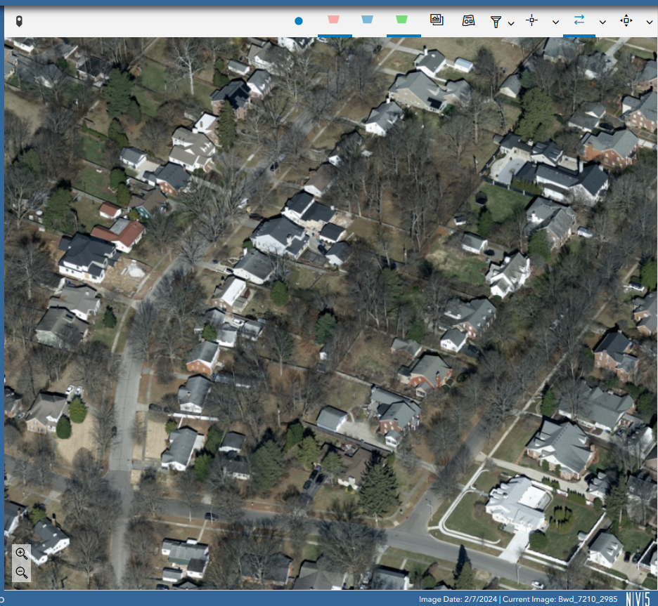
The Commonwealth of Kentucky has launched a groundbreaking new Nadir and Oblique Statewide Image Viewer as part of its KYFromAbove initiative—a statewide program providing high-resolution elevation data and aerial photography. This next-generation, publicly accessible viewer covers all 40,000+ square miles of the state with detailed, interactive nadir and oblique imagery.
The viewer, built on Esri technology and developed by NV5, is fully owned and hosted by the Commonwealth. By providing Kentucky with complete ownership and control, the state now has a sustainable, scalable geospatial platform—one that empowers both public access and internal innovation without ongoing costs.
“This viewer is a major step forward not just in functionality, but in philosophy,” said Kent Anness, Geographic Information Officer for the Commonwealth of Kentucky. “This is the final step in the democratization of Kentucky’s aerial photography resources. We’re giving Kentuckians full, free access to their state’s imagery—while providing our agencies a flexible tool they can expand and adapt as their needs evolve.”
Key Features of the New Viewer:
· Free, Public Access — No logins, licenses, or subscriptions required
· State-Owned and State-Hosted — Built in the cloud, deployed into Kentucky’s IT infrastructure
· Powered by Esri, Enhancements Developed by NV5 — A modern, stable platform customized for long-term adaptability
· Nadir + Oblique Views — Toggle between top-down and angled perspectives for deeper spatial insight
· Built for the Future — New imagery can be added over time without disrupting service
Kentucky now has full control over its geospatial assets. Agencies can add layers, configure tools, and integrate services independently, saving time and taxpayer dollars.
“This isn’t just a new viewer—it’s an investment in flexibility and sustainability,” Anness added. “By giving Kentucky full ownership, we’ve created a system that can grow and evolve with the state.” The platform is also compatible with other geospatial data layers that the state already has, further enhancing its value and utility. The view is live at: https://explore.kyfromabove.ky.gov/